

Rotareneg
-
Posts
2,206 -
Joined
-
Last visited
-
Days Won
1
Content Type
Forums
Events
Downloads
Articles
Posts posted by Rotareneg
-
-
In the attached scenario the Ulan platoon seems to somehow be in the wrong order and tries to rearrange itself with strange results. One of the vehicles just reverses off to the side until it automatically gets detached from the formation while the other two park next to each other.
formation_problem.sce formation_problem_4276_081122COMPY1410.aar
1 -
A couple nice things I noticed in the mission editor: "Engine off, if..." and Embark on route if "Unit this is done with fire mission".
Also... boats as an category of units?
0 -
If you already have a 4.1 license on your dongle you just need the "Upgrade License from version 4.1" one with is $40.
1 -
Ah, yep, that's it, I was testing against the Camcopter. It works against all the infantry deployable UAVs, but not the two "stand alone" UAVs.
0 -
I can't figure out the Bullitt drone. You can deploy it but it just sits there, not doing anything as drones go overhead. Is there some trick to getting it to work?
0 -
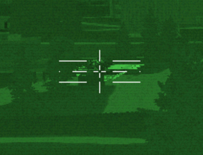
In the T-90 the commanders NSVT doesn't fire from the muzzle, it comes out above the base of the main gun:

In the T-80 the NSVT is locked forward and seems to be controlled by the gunner. Attached is a scenario showing both issues.
0 -
It was in normal play, not test mode, which was why I found it very strange.
0 -
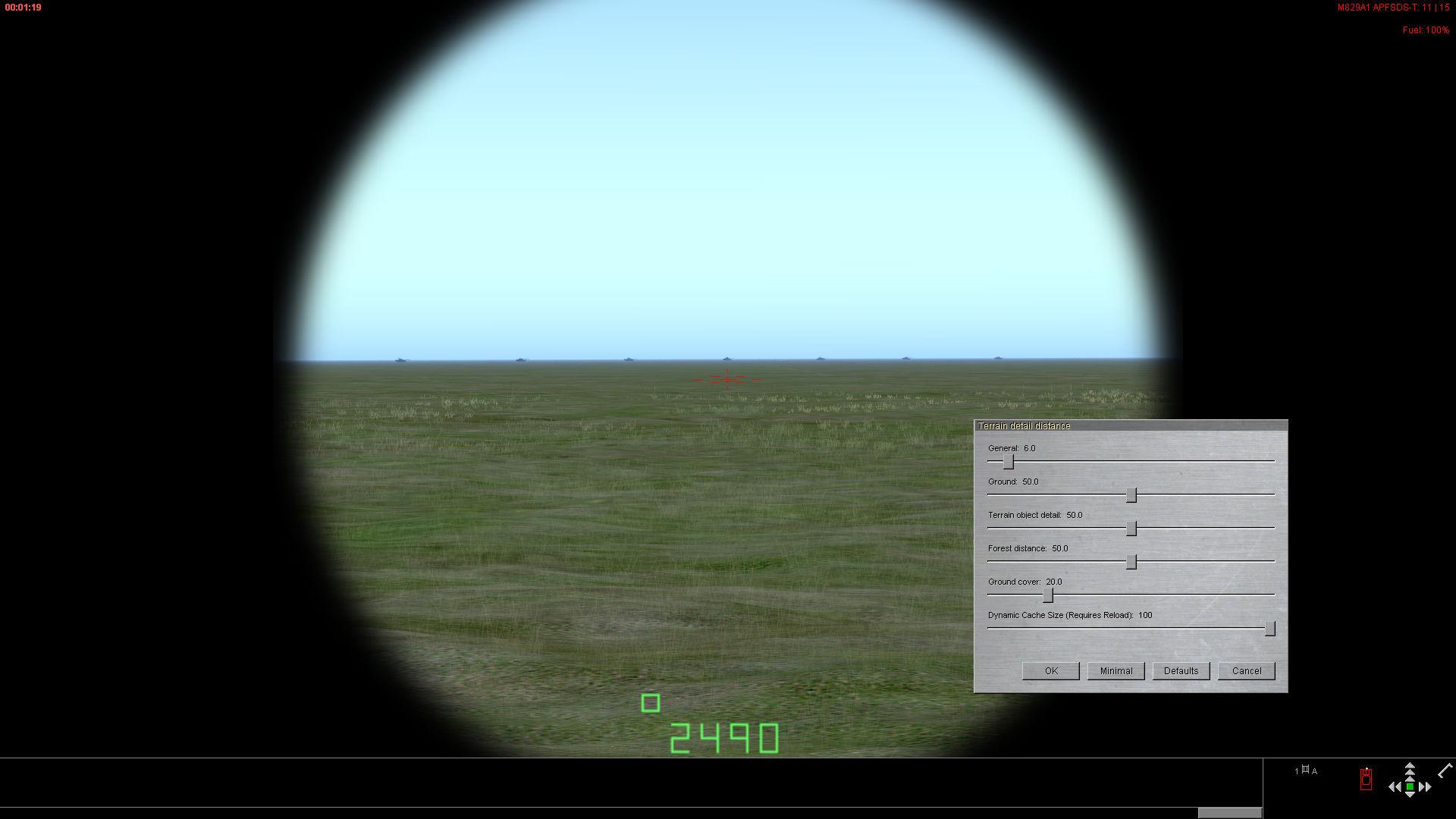
I noticed a particularly odd behavior related to this issue: If you turn on time acceleration in the attached scenario it won't automatically switch back to normal speed until the (blind) enemy tanks are a few meters from the blue ATGM vehicles even though the enemy tanks have been in clear line-of-sight long before that, as if the blue vehicles don't properly "see" the enemy tanks until they're at point blank range,
2 -
The commander's TIM on the 2A5 has lower noise and goes up to 24x zoom while the gunners TIS only goes to 12x.
0 -
0
-
Like you mentioned earlier the Terrain detail distance General setting needs to be very low for this effect to be so obvious. It happens sooner with the C2 daysight because it's got a bit wider field of view, making the angular size of the tanks smaller so they drop below the threshold at a shorter distance compared to the M1 daysight.
0 -
If I remember correctly, those have only ever been available when testing a scenario in the mission editor.
0 -
Yeah, I just checked the BRDM-2 out and something is up with that: The MDZ and MDZ-M ammo has an enormous amount of muzzle blast, roughly on par with the CV90/40 I used for comparison while the default AP ammo didn't kick up any dust.
1 -
Ah, just checked and SB's CPU usage goes way up when that window is open, it just didn't have an effect on the frame rate in the map view.
0 -
Just noticed this while looking at the exploding moon issue: If use the ALT-S shortcut to open the mission time and date window while in the 3D view in the mission editor it cuts my framerate in half, from the 62.5 FPS limit to around 30. No other UI panel does this, and it doesn't happen in the regular 2D map view in the editor.
0 -
At 16:31 on the attached scenario the moon suddenly becomes as bright as the sun and the sky likewise is bright like daytime, but the ground remains dark:
0 -
Incremental time starts counting when a unit arrives at a waypoint, so if you have a route leading away from a waypoint with a embark if condition set to incremental time > 5 min they'll hold there for 5 minutes before moving on.
4 -
Your SB install has gotten messed up somehow, this is what should be present along with the main SB executable:
0 -
NTFS compression works extremely well on those files, so if you're going to be doing height adjustments on a map you might consider turning compression on for that folder. An 7.6 GB .hnt file created from leveling a couple roads on a map compressed down to 952 KB.
0 -
Just noticed this problem still exists up to 4.259. I know the map editor needs a total overhaul, but this seems like a relatively simple to fix (famous last words) off-by-one error.
0 -
Because the terrain types in a theme aren't fixed, you can change them as you wish including changing names, colors, type and size of random objects (grass, rocks, etc.,) textures, and more.
0 -
Attached is a version of the map with a wadi terrain on the streambed, so it should be essentially impassable as the wadi terrain is set to be low traction/high drag making it a tank trap. If you want the wadi terrain to be a bit more forgiving unless vehicles actually fall into a deep part you can edit the Streambed drag and/or traction to make it less slippery.
0 -
I roughly sketched out the hills and wadi in GIMP and saved as a greyscale .png, loaded that into Wilbur to do various terrain processing things, exported it as an 8 bit .bmp height map file, loaded that back into GIMP, flipped it vertically (for some reason SB1 maps are flipped on the N-S axis) adjusted the levels to get the elevations roughly where they need to be, saved that as a raw file and then used a hex editor to add the width and height to to beginning of the file, renamed the file extention to .hgt, put it on the maps folder where the old style maps are stored (not the new 4.1 style maps,) and then used the import .hgt function in the map editor.
0 -
I drew up a crude map in GIMP, gave it some erosion with Wilbur and then imported it into SB as an 8 bit raw image, SB1 style. The map is "unpublished" so you can edit the actual terrain and theme however you like, I just tossed in some different terrain for the hills so it wasn't all the same scrubland. The grid lines are offset a bit and the altitude is way lower as the old maps are only 0-100m, but the relative heights shouldn't be terribly far off.
0


Unit formation problems
in Support
Posted · Edited by Rotareneg
Four. I kept on running into this issue during a scenario (An updated version of Zipuli's Tank Platoon In Attack) where a vehicle would start backing away from a stay order line formation BP.