Pre 4.1 Terrain
88 files
-
Military Training Area Munster/North Germany
By LUPUS
Heigh Map and Terrain Map of the Traning Area of the German Panzertruppenschule. Areaname MUNSTER NORTH.1,329 downloads
(1 review)0 comments
Submitted
-

Minden_1010
By manteuffel
extracted from the Hannovermap. This area is chanced to the new housemodels473 downloads
(1 review)0 comments
Submitted
-

Mingachevir Terrain map
By DarkAngel
Mingachevir Terrain maps as requested by CharlieB. Created from OSM data (plus some tweaking).
170 downloads
(0 reviews)0 comments
Submitted
-

Munster Germany terrain Demonstrator
By DarkAngel
Here is a map of the Munster area in Germany. This map is a request from someone who is working on the map. Please do not edit this version and upload it. It is uploaded to showcase a new way of populating maps with buildings. Where the data is available maps like this are possible in a reasonably short period of time.371 downloads
(3 reviews)0 comments
Submitted
-

NATO Training Ground BERGEN
By Eisenschwein
Biggest Training Area in GE 18 x 22 Km. Requires the SCHWARMSTEDT - SOLTAU height map.1,740 downloads
(4 reviews)0 comments
Updated
-

Newcastle
By companyteam
Approx 20km x 20km. Based on Newcastle (Australia) CBD, although the surrounds are fictitious. Includes port and airport to north, and surrounding farmland and villages. Mix of eastern and western urban areas. Height file updated (thanks to Dark Angel). Minor tweaks in this version of the .ter (bridges and little else). I'll include Dark's Newcastle height file, a file called "trial.hgt" which is the height file I used for the Newcastle .ter (unimaginative, but it was my first go!), and the .ter file itself (v1-1).549 downloads
(2 reviews)0 comments
Updated
-

NGP_Bergedorf
By DarkAngel
60 x 40 km area of the North German Plain east of Hamburg. As requested by Hermes. This is Generated from OSM data.358 downloads
(0 reviews)0 comments
Submitted
-
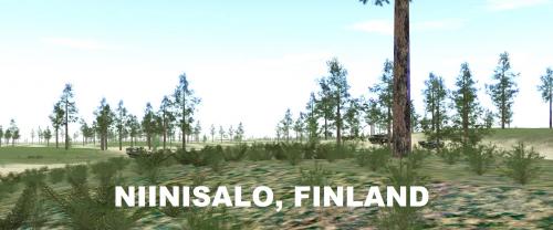
Niinisalo Training Area, Finland
By Zipuli
Welcome to Niinisalo! The 28x48 km area in this map covers the training grounds, used commonly by Finnish mechanized forces in maneuver and live fire exercises. The Pohjankangas -area north of Niinisalo Garrison provides a long open stretch of terrain that has subtle height variations, providing good hunting grounds for tanks, while the wooded areas surrounding allow mechanized infantry to fight dismounted.
Height and Terrain maps included. You can use Kouvostoliitto themes with this map.
Version 1.1 has some minor details added to Pohjankangas, along with more realistic vegetation (less visibility outside the "desert").566 downloads
(1 review)0 comments
Updated
-
 (1 review)
0 comments
Updated
-

Paderborn_0113 (2.654)
By manteuffel
Most of all is complete. Only the Part of Hannover-map must be insert. The Areas at the borders also need a bit improvement. Enjoy the map !1,116 downloads
(7 reviews)0 comments
Updated
-

Pahkajarvi Training Area, Finland
By Zipuli
This is a map of the Finnish Army training area Pahkajärvi, in south east Finland, near Karelian Brigade. In this area, the Finnish Army conducts live fire exercises and manouvers with infantry, armoured vehicles, anti-tank weapons including ATGMs, mortars, field artillery, multiple launch rocket systems, etc.
- Map size: 20 x 20km, covering the whole training area and its surroundings.
- Height map is DTED3 (10m resolution), 2012 data
- Terrain map by Zipuli and pvt Järvinen, KYMJP
- 5 theme files included for all seasons
See you at Loiri! Bring Your Own Bombs!353 downloads
(5 reviews)0 comments
Updated
-

Palava, CZ Terrain map
By DarkAngel
Palava region of Cz as requested by JustSomeGuy
Map is created from OSM data.290 downloads
(1 review)0 comments
Submitted
-
Reichswald_Winter_highflow
By manteuffel
After the blasting operation of the rhine and the Meuse. Stoneless Woods and change the highflow-Water to bog. This is the terrain for the Campaign Reichswald at 08.02.2009 Qsteelbeasts.eu817 downloads
(1 review)0 comments
Updated
-

Rovajarvi, Finland
By Zipuli
Welcome to Rovajarvi training area, Finland. It's one of the biggest training grounds in Europe, located in the northern third of Finland between towns of Rovaniemi and Kemijarvi. Here the Finnish Defence Forces train especially in the use of artillery and anti-tank weapon systems, but from time to time the Army uses the area for large scale maneuvers, like the "Trombi" ("Tornado") exercise in 2013 between two battalion battlegroups along with all the supporting arms. The terrain is just as difficult as the climate: During mid summer the sun does not go down at all and during the heart of winter the soldiers cope with endless darkness, frost and deep snow. Whatever the time of year, the flocks of reindeer get in your way and these animals are stubborn enough to stop an advancing mechanized battalion on their tracks, not giving way, and sometimes running straight into artillery splash zone when the grenades are already in the air... Reindeer meat anyone? Truly a place to take the military equipment to their limits:
https://www.youtube.com/watch?v=OvmBuk39e9k&list=UUM8qGnJrcCGQXCZuGenvrOQ (mechanized units in action during "Trombi 2013")
It's recommended to use the Suomussalmi -map themes, that come with the installer, with this one.348 downloads
(1 review)0 comments
Submitted
-
Salisbury Plain
By Stuart666
A terrain map of the Salisbury Plain training area in Southern England.574 downloads
(2 reviews)0 comments
Updated
-

Salisbury Plain Training AreaV2
By Stuart666
A representation of the Salisbury Plain training area in Southern England. Please delete all pervious versions. The recently released version had a fault that will stop it working correctly. Please update it to this latest version. This includes the new height map Salisbury Plain-0.hgt, which has been causing problems.657 downloads
(2 reviews)0 comments
Updated
-
 (1 review)
0 comments
Submitted
-
Satun Front (V3)
By Overlord
A new terrain based in Newrivervalley.hgt, with, I create more citys, towns, roads, farmings and cultivations, inclusive a military base. More playable than the original for our tanks a mechaniced units.213 downloads
(1 review)0 comments
Submitted
-

SCANIASE / Skåne
By AlphaSierra
This is the summer update of ScaniaSE.ter Info: Covers south part of Skåne/Scania province in Sweden. From the city of Lund in NW to the city of Ystad in SE Size: 50 x 50 km Heightmap: Sweden1.hgt (original SB map) Latest updated: 2012-05-18 Stay tuned for new updates ;)1,031 downloads
(8 reviews)0 comments
Updated
-

Schwarmstedt-Bergen-Munster_summer.ter
By Abraxas
From SCHWARMSTEDT in the South-West, crossing River ALLER, NTA BERGEN and MUNSTER-SOUTH towards military airfield FASSBERG and UNTERLÜß in the East. A revised and enlarged map to West-East-grid line 90.5 is available.
Screenshots of the terrain you can see on www.steelbeasts.org/Editorforum/Kartenerstellung/Bergen!
With the version 4.250 this map is no longer required and is automatically replaced by the supplied map "Bergen-Soltau-Munster"!
648 downloads
-

small afghan map
By 29 stumps
A SMALL MAP THAT MIGHT BE GOOD FOR TANKS AND APC TRAINING, SOME VILLAGES FOR TALIBAN TO HANG OUT.445 downloads
(0 reviews)0 comments
Updated
-
Stockton CA Terrain
By DarkAngel
Basic terrain file derived from OSM data. Contains terrain, roads, basic waterways and rail.
Currently does not have buildings or walls.179 downloads
(0 reviews)0 comments
Submitted
-
Suwalki terrain maps
By DarkAngel
These are the current Suwalki gap terrain maps. They represent the development from blank map to propagated maps. 3A2 is the best one so far. I include the others just for reference for those interested.
111 downloads
(0 reviews)0 comments
Submitted
-

Suzon Valley unofficial update
By Azure Lion
This is my attempt to clean up the Suzon Valley map. Made the effort to adjust and align (hopefully) all bridges and roads. Made the city look more like a city. I placed this ter file in my scenario download as well (North Korean Offensive), so no need to download here if you get the scenario file. Please feel free to use and change as you like. Uses original associated hgt file.224 downloads
(0 reviews)0 comments
Submitted
-
Tegernsee
By LUPUS
This Zip File includes Heigh Maps and Terrain Maps about the Austrian "Tegernsee" Area. Nice Area with some very high Mountains and some small nice villages.865 downloads
(1 review)0 comments
Submitted