Pre 4.1 Terrain
88 files
-
Tegernsee
By LUPUS
This Zip File includes Heigh Maps and Terrain Maps about the Austrian "Tegernsee" Area. Nice Area with some very high Mountains and some small nice villages.865 downloads
(1 review)0 comments
Submitted
-
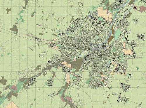
Military Training Area Munster/North Germany
By LUPUS
Heigh Map and Terrain Map of the Traning Area of the German Panzertruppenschule. Areaname MUNSTER NORTH.1,329 downloads
(1 review)0 comments
Submitted
-
(1 review)
0 comments
Submitted
-
(1 review)
0 comments
Submitted
-
(1 review)
0 comments
Submitted
-
Military Training Area Gera near Lonzig
By Blackhill
Military Training Area Gera near Lonzig655 downloads
(1 review)0 comments
Submitted
-

Kleve-Reichswald
By manteuffel
Orginalmap: Arnhem-Eindhoven.ter
Rond about 150 hours are invested in this map.
Enjoy it775 downloads
(1 review)0 comments
Updated
-
Reichswald_Winter_highflow
By manteuffel
After the blasting operation of the rhine and the Meuse. Stoneless Woods and change the highflow-Water to bog. This is the terrain for the Campaign Reichswald at 08.02.2009 Qsteelbeasts.eu817 downloads
(1 review)0 comments
Updated
-

Trentino-Alto
By manteuffel
Building up Merano (Meran) along the "Etschvalley" down to Bolzano (Bozen)
Some small passes (try´s) going from Bolzano to the highmontain region of Meltina-Hafling.
The Mendel-Pass is only "human usable".
Enjoy the Etschvalley574 downloads
(1 review)0 comments
Submitted
-
 (1 review)
0 comments
Submitted
-

El Alamein
By manteuffel
2nd part of Africa-Campain
Ghazala-El alamein-Hamman are ready.742 downloads
(1 review)0 comments
Updated
-

Fulda City and Fliede Valley V1
By WarUlf
Beta 1. Linkup of the Fulda and Fulda southern corridor maps.686 downloads
(1 review)0 comments
Submitted
-

Villers_Bocage_mtfl0810
By manteuffel
Enjoy the Normandy with new housemodels. For version 2.5x620 downloads
(1 review)0 comments
Updated
-

Minden_1010
By manteuffel
extracted from the Hannovermap. This area is chanced to the new housemodels473 downloads
(1 review)0 comments
Submitted
-

Kuwait Oil Fields
By 29 stumps
oil rigs and city streets to do some battle against iraq forces from 1991. Big thanks to the maker of port terrain map,529 downloads
(1 review)0 comments
Submitted
-
Kouvostoliitto, Finland (3.0)
By Zipuli
An update to the map that comes with SB Pro PE 3.0.
Version 1.1:
Added detailed areas of
- In the north from Jaala to Tuohikotti
- Kaipiainen and Sippola towns
No navmesh to keep the file size smaller. Create one when making a scenario, or in the map editor.315 downloads
(1 review)0 comments
Submitted
-

Triades_Flussebene_Modified_v5_Map
By enigma6584
A nice little remake of a European style map. The map has some interesting tactical possibilities. For example; plenty of cover and concealment for mech scouting operations, open terrain for fast and large mech ops, strongpoint defenses in the cities covering avenues of approach, major river to cross with three bridges on map to defend or take. Good atmosphere for European operations in both west and easter areas.249 downloads
(1 review)0 comments
Submitted
-
 (1 review)
0 comments
Updated
-
 (1 review)
0 comments
Submitted
-

Tskhinvali Georgia
By DarkAngel
Terrain Map of Tskhinvali Georgia as requested by Toyguy. This is derived from OSM data379 downloads
(1 review)0 comments
Submitted
-

Fulda - Bad Hersfeld 2014 (v3.002)
By Falli
The previous Fulda Gap_alt-map was completely reworked, corrected, updated and extended with additional 1400skm.
Around 2000sqm of German Hessia and Bavaria, thousands of km of German highways, streets, roads, dirt roads are expected to be driven on.
It builds the exteriour to Eisenschwein´s HUENFELD map and has connection points to it in S, W and N direction.
Authors: Falli (PzBtl911)
Included:
- Map
- FuldaGap height map
- 5 different terrain themes (Spring, Summer, Autumn, late Autumn, Winter)
Successfully tested with v.3.002
Origin:
Fulda Gap_alt: eSim Games
Recommended mods:
- German Roadsigns Fulda
- German Buildings Woodland
- German Buildings Winter
The files are licensed under Creative Commons CC BY-NC-ND 3.0527 downloads
(1 review)0 comments
Submitted
-

Meride EU terrain map
By AlphaSierra
Another fictional map with exceptional heightmap for armored warfare. Rivers, hills, small villages, cities, rolling landscape, deep canyons, military compounds etc.
Both terr and hgt file are in the file.
NOTE: This is a big file 74 mb
If you have questions how to install map, look here: http://www.steelbeasts.com/sbforums/showthread.php?t=6417623 downloads
(1 review)0 comments
Updated
-
Satun Front (V3)
By Overlord
A new terrain based in Newrivervalley.hgt, with, I create more citys, towns, roads, farmings and cultivations, inclusive a military base. More playable than the original for our tanks a mechaniced units.213 downloads
(1 review)0 comments
Submitted
-
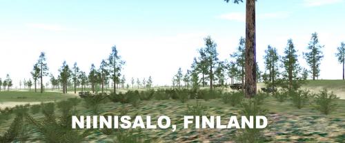
Niinisalo Training Area, Finland
By Zipuli
Welcome to Niinisalo! The 28x48 km area in this map covers the training grounds, used commonly by Finnish mechanized forces in maneuver and live fire exercises. The Pohjankangas -area north of Niinisalo Garrison provides a long open stretch of terrain that has subtle height variations, providing good hunting grounds for tanks, while the wooded areas surrounding allow mechanized infantry to fight dismounted.
Height and Terrain maps included. You can use Kouvostoliitto themes with this map.
Version 1.1 has some minor details added to Pohjankangas, along with more realistic vegetation (less visibility outside the "desert").566 downloads
(1 review)0 comments
Updated
-

Golan Heights 1973 (3.011)
By LtGeorge
Basic terrain map with most of the Israeli side of the Golan Heights filled in. Includes key villages on both sides. Does not include small details such as tank ramps or low-level roads or trails. Border is based on the 1973 Purple Line.404 downloads
(1 review)0 comments
Submitted