
DarkAngel
-
Posts
2,098 -
Joined
-
Last visited
-
Days Won
1
Content Type
Forums
Events
Downloads
Articles
Files posted by DarkAngel
-
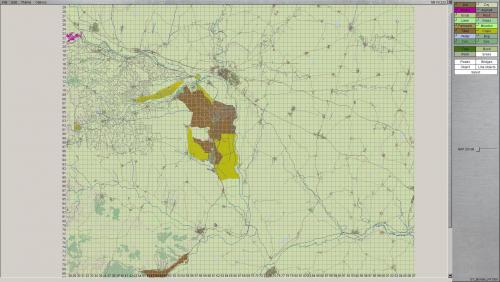
Suwalki terrain maps
By DarkAngel in Pre 4.1 Terrain
These are the current Suwalki gap terrain maps. They represent the development from blank map to propagated maps. 3A2 is the best one so far. I include the others just for reference for those interested.
111 downloads
(0 reviews)0 comments
Submitted
-
Suwalki Gap Height maps (2x)
By DarkAngel in Pre 4.1 Height
Two (optional) heightmaps for the Suwalki gap. One is from SRTM30 the other is JAXA (ALOS)
Looking at the data the JAXA / ALOS version seems the best. I haven't checked in SB as to how noisy the data is.
122 downloads
(0 reviews)0 comments
Submitted
-
(1 review)
0 comments
Submitted
-
Golan Revised Alternative hgt
By DarkAngel in Pre 4.1 Height
This is an alternative (test) heightmap using the 30m Jaxa data. To use it Back up any existing Golan revised height map and then rename this hgt to Golan_Revised.Hgt
90 downloads
(1 review)0 comments
Submitted
-
Alternative Golan revised
By DarkAngel in Pre 4.1 Terrain
An alternative terrain map for the Golan revised map. Warning it looks horrible in the editor, this is so I can see what the terrain types are doing. This is a mix of OSM data with a soil based terrain. I've added tank ditches and bunker positions (hesco barriers). This requires 4.023 for the terrain tiles which are custom. Some of them may need some tweaking.
115 downloads
(1 review)0 comments
Submitted
-
Dejawolf's T-55 Template
By DarkAngel in Vehicle Templates
Dejawolf's T-55 Template (A few of my camo layers are in it too)
39 downloads
(0 reviews)0 comments
Submitted
-

Golan heights revised 30m
By DarkAngel in Pre 4.1 Height
Another version of the Golan Heights revised Height map. This is made from srtm 30m data re-sampled at 12m
150 downloads
(0 reviews)0 comments
Submitted
-
Greek Turkish Border (North) Height map
By DarkAngel in Pre 4.1 Height
Height map for the Greek Turkish Border (North) as requested by Iskios. Map is created from 30m SRTM data sampled at 10m.
137 downloads
(0 reviews)0 comments
Submitted
-

Greek Turkish Border (North) Terrain
By DarkAngel in Pre 4.1 Terrain
Northern Portion of the Greek Turkish Border as requested by Iskios. Created from OSM Data.
196 downloads
(0 reviews)0 comments
Submitted
-

Mingachevir Terrain map
By DarkAngel in Pre 4.1 Terrain
Mingachevir Terrain maps as requested by CharlieB. Created from OSM data (plus some tweaking).
170 downloads
(0 reviews)0 comments
Submitted
-

Mingachevir Height map
By DarkAngel in Pre 4.1 Height
Mingachevir Height map as requested by CharlieB. Map is created from 30m SRTM data sampled at 10m.
135 downloads
(0 reviews)0 comments
Submitted
-

Fulda gap (Alt) 2 Height maps
By DarkAngel in Pre 4.1 Height
Height map for the Alternative Fulda Gap terrain map.
There are 2 versions of the heightmap one is derived from 90m SRTM sampled at 30m the other is 30m SRTM sampled at 30M.
233 downloads
(0 reviews)0 comments
Submitted
-

Fulda Gap (Alt) 2
By DarkAngel in Pre 4.1 Terrain
A revisit of the Fulda Gap map. The original was too far east. This is moved 30-30km west to better represent the are in which fighting would probably have taken place.
Map is developed using OSM data and I have included the different stages of development for anyone who is interested.
354 downloads
(1 review)0 comments
Submitted
-

Gotland Terrain
By DarkAngel in Pre 4.1 Terrain
Gotland map as requested by KT (and others). Data was sourced for me by Profevil.343 downloads
(1 review)0 comments
Updated
-

Gotland Height
By DarkAngel in Pre 4.1 Height
Gotland Map as requested by KT (among others). Map is created from 2m Lidar data re-sampled to 10m. It does need some cleanup around the coast.235 downloads
(1 review)0 comments
Submitted
-

Greek/Turkish Border Height
By DarkAngel in Pre 4.1 Height
Greek Turkish border as requested by Isikios. Created from SRTM data re-sampled at 30m214 downloads
(1 review)0 comments
Updated
-

Greek/Turkish Border Terrain
By DarkAngel in Pre 4.1 Terrain
Greek Turkish border as requested by Isikios. Created from OSM data. Pretty sparse as there is not a huge amount of data available.237 downloads
(1 review)0 comments
Submitted
-

Klietz, Germany Terrain
By DarkAngel in Pre 4.1 Terrain
Klietz Area as requested by Eisen. Map is created from OSM data. I have included the different iterations for anyone interested in the stages of the process. The Klietz_1C.ter is the most complete version.264 downloads
(1 review)0 comments
Submitted
-

Klietz Area Height
By DarkAngel in Pre 4.1 Height
Klietz area as requested by Eisen. SRTM data imported at 30M.213 downloads
(1 review)0 comments
Submitted
-

Palava, Cz Height Map
By DarkAngel in Pre 4.1 Height
Height map of the Palava region of Cz as requested by JustSomeGuy.
Map is created from SRTM data Re-sampled to 30M256 downloads
(1 review)0 comments
Submitted
-

Palava, CZ Terrain map
By DarkAngel in Pre 4.1 Terrain
Palava region of Cz as requested by JustSomeGuy
Map is created from OSM data.290 downloads
(1 review)0 comments
Submitted
-
Stockton CA Terrain
By DarkAngel in Pre 4.1 Terrain
Basic terrain file derived from OSM data. Contains terrain, roads, basic waterways and rail.
Currently does not have buildings or walls.179 downloads
(0 reviews)0 comments
Submitted
-
(0 reviews)
0 comments
Submitted
-
Ljubljana Gap Terrain Map
By DarkAngel in Pre 4.1 Terrain
Ljubljana Gap as requested by AlesMrak (Dr Jones). This is derived from OSM data. Contains around 40,000 buildings.263 downloads
(0 reviews)0 comments
Submitted
-
Ljubljana Gap Heightmap
By DarkAngel in Pre 4.1 Height
Ljubljana Gap as requested by AlesMrak (Dr Jones) This is an 80x80km map derived at 30m from SRTM 90m data.265 downloads
(0 reviews)0 comments
Submitted