

DLDC_Sims_guy
-
Posts
70 -
Joined
-
Last visited
-
Days Won
1
Content Type
Forums
Events
Downloads
Articles
Posts posted by DLDC_Sims_guy
-
-
I am looking into creating vehicles that will work in the game. I have been designing/editing 3D models specifically for 3D printing in resin at small scale, and I have a pretty large number of vehicle models that are "game ready". I was wondering what format/requirements SB has for vehicle models. I want to model a lot of the "support" stuff, like the new AMPV and JLTV lines of vehicles, as well as many of the LMTV/FMTV/HEMTT vehicles, trailers, radar and satcom stuff. You know, the ash & trash. They won't add much by way of effect(s) in the game, but will provide a more realistic look and feel on the battlefield, and maybe even a new dynamic, with supply route protection missions, rear area security missions and the like.
Any information on creating actual vehicle models for SB would be appreciated.2 -
Looks like this scenario is becoming more relevant! Russia Makes Threat to Sweden...
0 -
As a user of both, I try to keep comments here limited to Pro PE, otherwise it can cause confusion.
Where, then, can I speak of Pro without fear of confusion?
 0
0 -
The latest Pro (not PE version) has a few GP Medium military tents in the "military" category.
0 -
It certainly depends on the application case. If all that you want are some virtual helicopter flights, then "looking good" is all that is required, yes. If you want to wargame a combat scenario, you probably want to have internal walls to compartmentalize fragmentation damage from projectiles passing through the outer wall as a more realistic representation of the protection effect that buildings have.
Now, the problem is that digital content often develops a life of its own. We still carry around maps that were created for Steel Beasts 1, more than fifteen years ago, when we had no idea bout the scope that we would try to cover one day. Just like that, digital maps and scenarios, once created and left for others to use and to modify them, develop a life of their own. They mutate, but they certainly live longer than the original software version for which they were created.
So, what do you do once that the simulation develops new capabilities? Maintenance of the object library becomes an issue. You may notice that for version 3.0 we reworked the "dirty dozen" of the oldest and ugliest building models in SB Pro while maintaining their original shape and footprint for backwards compatibility reasons. This wasn't a mere facelift with prettier textures, the buildings were replaced with models that conformed to new standards to support coming features in SB Pro.
So, at least we as the developer have some responsibility to think about these issues in order to protect our customers' investment, the stock of maps and scenarios that they use for training.
We are in violent agreement. I wasn't complaining, just musing about what would be good to see. I DO appreciate the tents and other items you added in the most recent version! :luxhello:
0 -
Yes. But they have to work in game an NOT only look nice. :-p
Not sure what you mean by "work", as a static object with no movement or capabilities beyond blocking sight and movement are necessary. i don't even want "destructablity".
0 -
I have not seen any process, since I am not involved in it in any way. But I think the idea being proposed is that a larger community can have access to the code or submit environmental objects, and they will be in the download section pretty quick. That I know is not the current process. It's not enough to only create objects to populate the map, they have to have associated sound files, the other points I have mentioned. If it's happening as you say, then it's a few people creating the objects, and they are released with major updates, something you'd have to wait for anyway.
Unless an object is made to be interactive, you really wouldn't need much at all by way of associated files. I'm looking more for ambiance and more variation of objects.
0 -
Well, I am currently using SB Pro (not PE) to create flyover videos of actual terrain. I use Google Earth for positioning of buildings, trees, and sundry other items to replicate actual areas here in the Midwest. It would be nice to have a larger geo-typical building database to work with, but it isn't a show-stopper. Was just wondering if we would be able to access the database and look-up procedures so we could add our own models to the mix. It would really open-up the flexibility and realism I could attain. I would compare it to the data found in VBS3, which allows me to create, import, and use 3D objects. Unfortunately, creating a map is a gruesome and evil bitch...
0 -
Any chance of either an updated set of building models to better represent various regions? How about opening-up the process to REALLY create "mods" other than skins? Not talking about vehicles at this point, but only static items in the "objects" database.
Thanks,
Curt
0 -
Is it in the appropriate projection?
There may be a difference between the map projection and the required output.
I tend to prefer using UTM or some variation on this (with planar, rectilinear coordinates in metres), rather than Geographic (with spherical angular coordinates) for working in local areas. This might not be appropriate for the task in hand, but it would be the first thing that I checked to try to work on a map for a tactical game.
I am using the UTM projection (WGS-84).
0 -
There are a few issues with importing shapefiles. Assuming you are using pro in the first place.
Firstly you want to separate them into road types. A decent GIS package will let you do this. You don't want to be changing the road types after you import them apart from some tweaking. Importing every road as the same type is a recipe for lots of work.
Secondly you need to make all of the roads contiguous. Most available data breaks roads into small sections with the breaks coinciding with intersections.
To the best of my knowledge SB doesn't like this. Doing this manually is an utter pain in the arse. I wrote a piece of code to avoid this and removed about 2 weeks of painful work from map making.
Thirdly you need to know what projection and datum the data is in. When you load the data into pro you are presented with a pop up window with a pull down menu. The menu is used to set what projection to load from (Meters = UTM/MGRS/TM. Feet I assume is the same but with Imperial. Degrees/Radians = Lat/Long). The datum is what you set when creating the heightmap and is usually WGS-84.
For a good cut price GIS program I use Global Mapper.
I keep getting an error saying the shapes I am importing are off the map and showing some funky coordinates for the shapes:
1.15'19.43"N/100.33'57.80"W
1.16'45.74"N/100.32'19.15"W
when the coordinates SHOULD be:
38.53'7.98"N/95.36'21.02"W
39.39'28.73"N/94.46'23.49"W
This was using METERS as the discriminator when importing. When I try the others, I get 0's for the coordinates of the shapefile.
I've attached some pics of the save dialogue from Globalmapper. What am I doing wrong?
0 -
Got it. Thanks! I have GM 11, and I should be able to do all of this, no problem. The combining segments and separate files for different roads was/is the key!
0 -
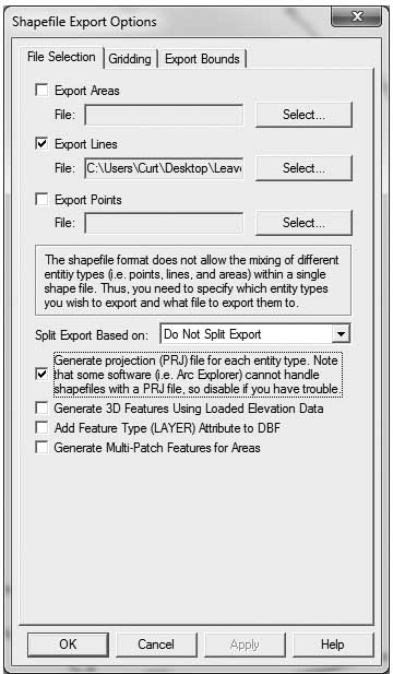
I am looking at building a rather large map of the terrain near where I work. I have the elevation data and have no trouble at all bringing that into a map. The problem comes with roads. I could spend the next six months laying down everything from scratch, but I have no desire to do it. I have the shapefiles, but continually get an error when trying to import them. Can someone give me some pointers on the art of shapefiles and getting them into a map? Do I need to do each different type of road in something like Globalmapper? Is there any way to just bring everything in as the same road type, then go through and change them in the map editor as needed?
Thanks in advance!
Curt
0 -
Email with file sent to your esimgames.com account!
0 -
The scenarios and supporting maps I am uploading were used to assist Magnus Frykvall of the Swedish Army prepare a Master's Thesis while attending the Command and General Staff College. The "Offense" scenario was designed to replicate the current plan to repel an invasion by Russia on the Swedish mainland by vigorously attacking a much larger invading force while outnumbered approximately 3 to 1. The "Defense" scenario was based on MAJ Frykvall's theory that a layered defense is the better option, preserving both lives and combat power. I recommend a full reading of MAJ Frykvall's paper to fully understand each scenario.
This was my first real attempt at building a scenario from scratch in SB. It's far from perfect, but I believe it accurately represents both the current doctrine and that proposed by MAJ Frykvall.
Unfortunately, the file for the Defense is too large, even when zipped with "ultra" compression, to allow it to be uploaded. Hopefully Nils can assist me to get the Defense file uploaded.
Curt Pangracs
1 -
I'll be glad to upload them. I should mention, though, that the scenarios were built using a version of SB Pro that may not have been available to others, so I don't know if it will work for others. In addition, these scenarios were created to run autonomously.
0 -
Well its Sinai in 1973 so I doubt any T-72's, since AFAIK Egypt never used it.
So T-62s at best.
You could always play it?
I could send you my info. I researched the 1973 campaign in the Sinai quite extensively for a game I made a few years back called The Star and the Crescent for ProSIM. Let me know.
0 -
Well, if I were a betting man, I would say that is wadding and whatnot that flies out of the muzzle. Of course, it probably isn't, but that makes sense to me...
0 -
Hello!
What area of Sweden are you interested in?
None. I already completed what I needed using a map in Sweden. Now I'm building a map of the Fort Leavenworth, KS, area.
0 -
What datasets are you using?. For US maps USGS is your friend (http://viewer.nationalmap.gov/viewer/). It has 10m height data (NED 1/3rd arc second) and vector road data (which unfortunately is not categorized). You can get better road data from the Tiger data (http://www.census.gov/geo/maps-data/data/tiger.html )
I've been able to cobble most everything together, including USGS, TIGER, and even Open Streets map data. The hardest part will be all of the buildings in each city. This is a huge map. It's easy enough importing all the schools and Churches and such and assigning them the same building type. Unfortunately, the editor doesn't allow one to create an area and fill with random buildings. Oh, how sweet that would be!
0 -
I got it working. I noticed that I had the map set using Lat/Lon in Globalmapper, but the original map I created for SB was in UTM. As soon as I exported the vector data using the UTM format, everything started to work. Unfortunately, the data I can find for the area is kind of crappy. I tried using Open Streets data, but about 50% of all road segments shifted a node to one position on the map! So, I have to go with some very low-res VMAP data.
0 -
So, are you saying that I need to go outside of the map boundaries in Globalmapper? Do I also need to join same-type roads and such? Just not sure how to get the correct .shp files to come over. They are set-up in Degrees in WGS84.
0 -
Darkangel - sorry it took so long! I honestly don't remember the exact map. I am (sporadically) working on one of the Leavenworth to Lake Perry, KS area. I was able to get the elevation in just fine, but I still can't seem to load any road data. I keep getting an error saying the locations of my import are incorrect, even though I took all of the data, to include the elevation, from the same predefined region from Globalmapper. I'm stumped, and haven't taken the time to scour these forums for an answer to the problem. If you have any pointers, by all means, I'm open to them!
The only thing I have figured I might be able to do is actually draw the roads, bridges, creeks, etc., in Globalmapper and then save them off as individual sets of different features.
My issue is that I keep getting the "DATA OFF MAP" error, so something is going wrong with what I'm exporting from Globalmapper.
Curt
0 -
Actually, it is also used at the US Army's Maneuver Center, more specifically in the Captain's Career Course there. Here at CGSC, it is primarily used in our elective courses for Simulation Operations Officers (FA57). This is the first time a student has used it in support of a thesis. I'm hopeful that, if successful, it may be used by others in support of a tactics-themed project.
0


Edit/Create New NATO Symbols?
in Mods
Posted
Is there a way to update the symbology used in SB? I did a cursory search for where they may be located, but they seem to be dynamically created maybe? Any help would be appreciated.